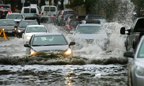
NEW YORK (TIP): Life-threatening flash flooding pummeled the New York City area Friday, September 29, as remnants of Tropical Storm Ophelia lashed the already heavily saturated region with several inches of rain in mere hours. All of New York City’s five boroughs were placed under Flash Flood Warnings on Friday, as torrential rains flooded streets and subway stations, causing massive system-side disruptions to rail and bus services. Impacts were especially felt in Brooklyn, where nearly 7 inches of rain had fallen by midday. “I want to say to all New Yorkers, this is time for heightened alertness and extreme caution,” New York City Mayor Eric Adams warned. “If you are home, stay home. If you are at work or school, shelter in place. For now, some of our subways are flooded, and it’s extremely difficult to move around the city.”
The FOX Forecast Center said radar estimated 8-12 inches of rain fell Friday over parts of Long Island. In the city, impacts were especially felt in Brooklyn, where more than 6 inches of rain fell.
Friday is now preliminarily the wettest day on record at John F. Kenney International Airport beating Hurricane Irene’s daily record which was set back on August 14, 2011, the National Weather Service said. Widespread rain totals of 4 to 6 inches were New York City, Long Island and Hudson Valley, with locally higher amounts in excess of 7 inches of rain. New York Governor Kathy Hochul declared a State of Emergency across the same areas due to the extreme rainfall.


Be the first to comment