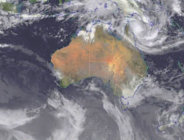
SYDNEY (TIP): A cyclone packing winds of up to 300 kilometres (190 miles) an hour was set to smash into Australia‘s Great Barrier Reef coast late on April 11, with officials warning the storm could wreak devastation. The maximum category five Cyclone Ita was expected to hit north of Cooktown, a coastal community of 2,400 people some 1,600 kilometres from Brisbane, bringing fierce gales.
“Anything over 80 kilometres (per hour) is dangerous,” Cook Shire mayor Peter Scott told the Australian Broadcasting Corp. “Anything over 80K will put a piece of tin through you and chop your head off, it will lift roofs off, it will make severe damage so the best place to be is staying inside,” he said. Scott said that in the view of one senior police officer in the area, “the Cooktown you see today won’t be here tomorrow”.
Queensland Premier Campbell Newman warned that homes built prior to 1985 when new building regulations were enacted may not withstand the impact of the storm, and urged residents to head to local cyclone shelters. “They need to do that this morning,” Newman said. “I urge people who are evacuating to make sure they grab all their… vital personal effects: things like passports, birth certificates.
“That they charge their mobile phone, they switch off the applications, that they take medications, food and water and make sure that they can look after themselves for a few days in the place they’re seeking refuge.” Ita sat some 175 kilometres northeast of Cooktown around midday (0200 GMT). A warning zone extended from Lockhart River in the far north to Innisfail in the south, and includes the Great Barrier Reef resort hub of Cairns.
Stronger than Yasi Tropical storms are common in northeast Australia and this one is stronger than the monster Cyclone Yasi system which tore through the region just over three years ago, ripping homes from their foundations and devastating crops. “Basically this is a very serious cyclone,” Andrew Tupper from the Bureau of Meteorology told the ABC. “It’s very compact, it’s an intense system.” The Bureau of Meteorology expects Ita to make landfall near Cape Flattery some 70 kilometres north of Cooktown on the sparsely populated Cape York peninsula around midnight.
It warned that while the strongest winds will be focussed near the eye of the storm, destructive winds, heavy rainfall possibly leading to flash flooding, and coastal inundation from a storm surge all pose threats. Brendan Cullen, manager of the Sovereign Resort Hotel, one of three hotels in Cooktown, said locals were used to cyclones and had prepared their homes and businesses by taping up windows and securing debris.
But he said there was a level of anxiety ahead of the storm: “We’re worried about it landing right on top of us and the storm surge. “As far as the general feeling in town, it’s a windy place anyway so it’s not as if there’s a lot of debris lying around,” he told AFP. “At this particular junction there’s a bit of anxiety. It stands to reason that if it comes this way with those winds… there’s going to be some sort of damage in town.


Be the first to comment